|
Post-fledging dispersal of Barn Owl in the lower Tagus Valley
|
||
|
|
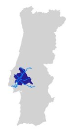
The study area includes the 10 municipalities (ca. 3.750 km2) located in the flat zone of the lower Tagus River and tributaries (from Santarém-Alpiarça in the northern part until Vila Franca de Xira-Alcochete in the south). With the set up of the telemetry task (schedule for 2009), the area will likely increase to ca. 17.800 km2.
|
|
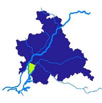
| The area of Ponta da Erva (Tagus Estuary) is in green. The broader light blue line represents the final stretch of the Tagus River. | ||


